Инструкция для Lincoln Navigator (2002) Navigation System

(скачивание инструкции бесплатно)
Формат файла: PDF
Доступность: Бесплатно как и все руководства на сайте. Без регистрации и SMS.
Дополнительно: Чтение инструкции онлайн
background image

When starting up, the navigation system may tell you: “You are leaving
the digitized area”. The displayed map will then show the vehicle
position off the road. If there are other roads in this area, the navigation
system may send inappropriate messages. This means that the system
assumes the vehicle is on one of the other roads.

When the vehicle has been parked for a long period of time, the
navigation function may be temporarily unresponsive. The
navigation system will operate reliably again once GPS
reception is available for a few minutes.

Limited GPS reception

System performance may be adversely affected if GPS reception is
interrupted or interference occurs over a distance of several miles. The
following are possible causes for GPS reception being interrupted. If the
vehicle is:

in multi-story parking garages,

in tunnels and under bridges,

in between high buildings,

by forests or tree-lined avenues,

in heavy rain showers and thunderstorms,

in valleys and in mountainous regions.

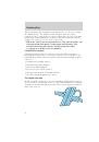
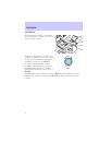
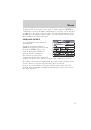
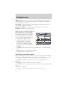
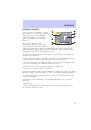
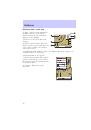
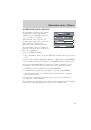
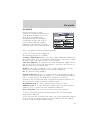
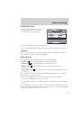
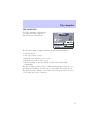
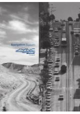
The digital road map

In order to plan a route, the current car position, destination location, as
well as all the roads in between are needed. This information is available
on digital road map CDs which you insert into your navigation computer.

Real road network

Introduction

4

1
2
3
4
5
6
7
8
9
10
11
12
13
14
15
16
17
18
19
20
21
22
23
24
25
26
27
28
29
30
31
32
33
34
35
36
37
38
39
40
41
42
43
44
45
46
47
48
Оглавление инструкции
  • Страница 1 из 49
    Table of contents Introduction 2 Controls 6 Menus 9 Start menu 12 Navigation menu 13 Guidance 19 Alternative route / Detour 23 Address book 24 Via points 27 Emergency 29 System settings 31 Trip computer 35 Map CDs 37 Maintenance 38 Glossary 39 Digital road map symbols 40 Troubleshooting 42 All
  • Страница 2 из 49
    Introduction GENERAL INFORMATION • After transport of the vehicle by a tow truck, car train or in a car ferry, the navigation system may need a few minutes outdoors for exact repositioning. • After the vehicle battery has been disconnected, the system may need up to 15 minutes for exact
  • Страница 3 из 49
    Introduction HOW DOES THE NAVIGATION SYSTEM WORK? The navigation system is a tool to assist the driver in daily traffic. The system allows you to enter the destination and activate “Guidance”, and the system provides guidance advice through both audio and visual advice. Determination of the vehicle
  • Страница 4 из 49
    Introduction When starting up, the navigation system may tell you: “You are leaving the digitized area”. The displayed map will then show the vehicle position off the road. If there are other roads in this area, the navigation system may send inappropriate messages. This means that the system
  • Страница 5 из 49
    Introduction Line pattern of the digital map On the map CD, the road network is stored as a line pattern, which means that even extensive junctions only have one center point all roads lead to. That is why the navigation system indicates the distance to the next turn as the distance to the center
  • Страница 6 из 49
    Controls CONTROLS The navigation system color display and the system controls are located in the center console. Turn the rotary button clockwise or SELECT counterclockwise to move the cursor on the screen. In this user manual, it will be referred to as SELECT. Press the rotary button to enter
  • Страница 7 из 49
    Controls SHORT-CUTS The navigation system has five “short-cut” buttons that can be found on the center console control unit. REPEAT Press “repeat” to receive the last REPEAT vocal guidance advice. This will only give advice if the “guidance” has been activated. MAP In certain screens the “Map”
  • Страница 8 из 49
    Controls ON/OFF When this button is pressed, the ON/OFF display will shut off and any programmed guidance will be canceled. If the display is dark and the ignition is On, pressing “On/Off” button turns on the display and the Start Menu screen is shown. SWITCHING ON/OFF The navigation system can
  • Страница 9 из 49
    Menus MENUS The individual functions are represented in the menus (identified by titles in the oval field at the top of the screen) as labeled, rectangular buttons. The current cursor position is marked in red. 1. Menu title 2. Buttons: Highlighted options can be selected. Options, which are
  • Страница 10 из 49
    Menus POP—UP MENU After selecting a function, a pop-up menu in the form of a rectangle may appear. You may select from the available options. To activate a particular option/function: 1. Move the cursor to the desired option/function by turning the rotary control. 2. Press ENTER to confirm the
  • Страница 11 из 49
    Menus To quit the list screen, move the cursor to “Quit” and press ENTER to confirm the selection. If further information on an entry can be invoked, “-” appears to the right of the list entry. To view this information: Press ENTER. By selecting the option “Quit,” you will return to the previous
  • Страница 12 из 49
    Start menu START MENU After turning the ignition on, the start-up screen will appear and then the legal disclaimer will be displayed. The legal disclaimer screen must be confirmed by pressing ENTER before going forward to the Start Menu. Acquaint yourself with the navigation functions by selecting
  • Страница 13 из 49
    Navigation menu NAVIGATION MENU • CHOOSE “Navigation” from the Start menu. • The Navigation menu is brought to the display. The following options are available: Country: To enter or change the destination country*. In case a country is already selected, the word Country disappears and the selected
  • Страница 14 из 49
    Navigation menu Address book: To store or recall destination addresses from a private or business database. It also allows the last 10 used destination addresses on a first in first out basis. Via points: To specify via points (intermediate stops) along the way to the entered destination address.
  • Страница 15 из 49
    Navigation menu 6. To insert a space, CHOOSE “Space” from the “keyboard.” 7. If you know the destination address exactly, enter the road and intersection the same way by using the options “Road” and “Intersection” in the Navigation menu. • You can only input the city name and the navigation system
  • Страница 16 из 49
    Navigation menu Selecting the destination from database entries Destination addresses (city, road, and intersection) can also be entered by selecting from the database entries using the “List” display. 1. CHOOSE “City”, “Road” or “Intersection” from the Navigation menu. 2. Enter the initial letters
  • Страница 17 из 49
    Navigation menu • This option may be limited in cities or towns which are not yet completely mapped. 3. CHOOSE the desired category (for example Hotel, Gas Station, ...). • If a larger number of facilities is available in the data base, the “keyboard” is shown. 4. Enter the name of the desired
  • Страница 18 из 49
    Navigation menu Facilities outside the mapped area With some map CDs, it is possible that the roads leading to a point of interest you previously selected are not or only partly mapped on the map CD. • As long as the roads are mapped, the navigation system will guide you in the direction of your
  • Страница 19 из 49
    Guidance GUIDANCE SCREEN Once you select “Guidance”, either the guidance screen or the map will appear. If you are on a digitized road, the guidance screen will appear. Otherwise, the map will appear. In case you entered a new destination address, it may take some time before the first guidance
  • Страница 20 из 49
    Guidance Guidance with a route map If “Map” option is chosen from the guidance screen, or the “MAP” button is pressed, the route map appears on the display. 1. Distance to the next direction change* 2. GPS reception status: When the GPS receiver receives valid data, the color of the satellite icon
  • Страница 21 из 49
    Guidance • Press ENTER to open a menu with the following options: Return: Back to the guidance screen. Scale: Changes the scale of the map. Confirm “Scale” by pressing ENTER, and choose the scale by rotating the rotary control. Confirm the new scale by pressing ENTER again. Positioning: Selects the
  • Страница 22 из 49
    Guidance Guidance in partly mapped areas In rural areas and smaller cities, not every road is mapped (stored on the map CD). When the vehicle leaves the mapped road, the system automatically changes from the guidance screen to map display at the 1/2 mile scale. • Drive in direction of a displayed
  • Страница 23 из 49
    Alternative route / Detour ALTERNATIVE ROUTE / DETOUR The navigation system can calculate an alternative route only during guidance for an adjustable distance, e.g. 1 - 10 km (1 - 6 miles). This function can be used to get around traffic jams or if you do not agree with the current route planning
  • Страница 24 из 49
    Address book ADDRESS BOOK The navigation system provides you with the option of storing 100 destination addresses in a personal address book, which is divided into 2 categories: “Business” and “Private.” CHOOSE “Address book” from the Start menu or the Navigation menu. The address book will be
  • Страница 25 из 49
    Address book • Road: The road name of the destination address * • Intersection: An intersection to specify your destination more precisely* or • a special facility from “Points of interest” * * Optional Notes: • 30 entries are the guaranteed minimum for the personal address book. The number of
  • Страница 26 из 49
    Address book Retrieve addresses from the address book 1. CHOOSE “Retrieve address” from the Navigation menu. 2. CHOOSE “Private” or “Business”. • The list of addresses already stored in the address book is displayed . • The list is sorted in alphabetical order 3. CHOOSE the desired address from the
  • Страница 27 из 49
    Via points VIA POINTS If you want to pass certain addresses or locations on the way to your ultimate destination, you can store these via points in the Navigation menu. The navigation system will calculate the route to next via point and will continue planning to the following via point, when the
  • Страница 28 из 49
    Via points 3. Select “Store via point,” and confirm by pressing ENTER. List via point: To show the list of stored via points. (max. listing of 25). • Select “List via point” in the Navigation menu. The list of stored via points will be displayed. Delete via point: To delete an entry from the list
  • Страница 29 из 49
    Emergency EMERGENCY SCREEN Select “Emergency” from the Start menu to display the emergency screen. The Emergency menu shows you the following information: • The Emergency screen shows the current vehicle position (city, state, road and vehicle latitude and longitude position as determined by the
  • Страница 30 из 49
    Emergency Limitations of the Emergency Feature The performance of the Navigation System Emergency function is limited by the following conditions: • If the ignition switch is not in the ON or ACC position. • If the vehicle is involved in an accident, damage to equipment may have occurred. • If the
  • Страница 31 из 49
    System settings SYSTEM SETTINGS To adjust the Navigation System to your own preferences, you can select many different settings. • Select “Settings” from the Start Menu. • The “System Settings” menu is displayed with the following options: Language There are two languages available, either American
  • Страница 32 из 49
    System settings Screen config. A variety of color combinations along with information shown in the satus line of the screen can be selected. • Select “Screen config.” from the Settings menu. • The “Screen Settings” menu is displayed. The following options are available: Day color / Night color
  • Страница 33 из 49
    System settings • Estimated time of arrival: Time you will arrive at the next via point or destination as calculated by the navigation system. For calculating the estimated time of arrival and remaining travel time, the system uses an average travel speed. You can adjust this speed to your real
  • Страница 34 из 49
    System settings Date/Clock The “Date/Clock Configuration” menu allows you to set the time and date format as well as the time zone. • Time format: Select between 12–hour format and 24–hour format. • Set time zone: Adjust the difference between your local time and Universal Time Coordinates (time
  • Страница 35 из 49
    Trip computer TRIP COMPUTER The trip computer is invoked by selecting the “Trip computer” function in the “Start Menu”. The integrated trip computer displays the following information: • Current speed • Avg. speed (since reset) • Elapsed route distance (since reset) • Elapsed travel time (since
  • Страница 36 из 49
    Trip computer SPEED WARNING If the speed warning is activated and the speed limit is exceeded, then audible info will be provided (tone) as well as a message on the screen. For example: this function is useful, if winter tires are used that require that a certain maximum speed is not exceeded.
  • Страница 37 из 49
    Map CDs MAP CD The navigation system utilizes a database stored in a special format on a CD. It is recommended always to use the latest update of this map CD. If you travel to different regions or wish to have more detailed information on a special area, refer to Ordering additional map CDs later
  • Страница 38 из 49
    Maintenance CLEANING THE DISPLAY Do not use lighter fluid, methyl alcohol or other solvents for cleaning. Only use a damp cotton cloth. 38
  • Страница 39 из 49
    Glossary GLOSSARY Map CD Compact Disc with CD-i format. CD which contains data only readable by a special CD player. Digitized road maps, city maps and a database of facilities of special interest (for example parking, hotels, restaurants, gas stations etc.) are stored on a map CD. GPS Global
  • Страница 40 из 49
    Digital road map symbols DIGITAL ROAD MAP SYMBOLS Several different symbols are shown in the map display depending on the amount of data base entries and on which category of special locations that have been selected in the destination input menu. The symbols can be identified as follows: Airport
  • Страница 41 из 49
    Digital road map symbols Library Marina Museum Park / Recreation / Fitness Police Public Parking Rest Area Restaurant School / College Shopping Mall Sports Arena Theater Tourist Attraction Tourist Information Train Station 41
  • Страница 42 из 49
    Troubleshooting TROUBLESHOOTING Symptoms System does not start, screen is dark. Possible Cause/Remedy •Turn on the ignition. Ignition already switched on; system is in stand-by mode: •Press the ENTER. •Press On/Off button. After a period of normal operation The temperature protection circuit the
  • Страница 43 из 49
    Troubleshooting Symptoms Color of the satellite icon on the GPS logo is constantly red. Display shows 9NO CD9 or 9WRONG CD9. Current time in the status line is wrong. Not possible to store address in the address book. Entered relocation intersection is not accepted during vehicle position input.
  • Страница 44 из 49
  • Страница 45 из 49
  • Страница 46 из 49
  • Страница 47 из 49
  • Страница 48 из 49
  • Страница 49 из 49